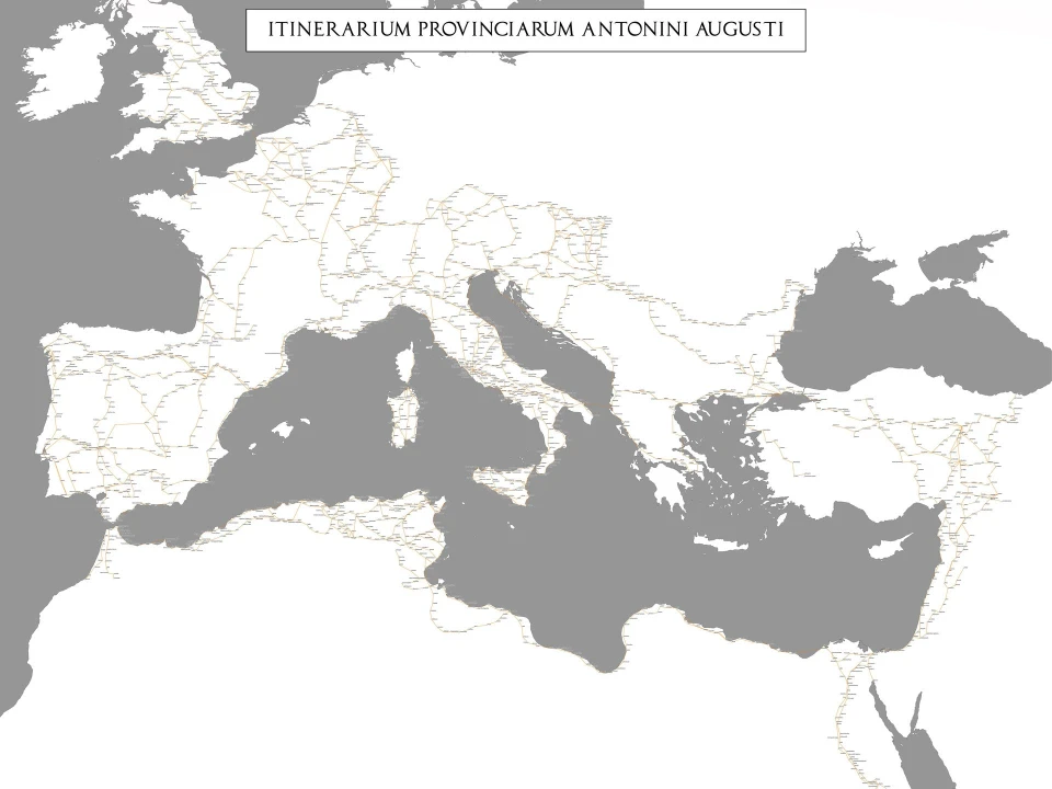
In the contemporary era, many individuals rely heavily on GPS navigation systems for even the simplest journeys, such as visiting a new grocery store. This dependence often leads to curiosity about how ancient civilizations, particularly the Romans, managed extensive travel and maintained their vast empire without the aid of modern, scaled maps.
The Romans, renowned for their expansive network of roads spanning three continents, primarily utilized "itineraria" for navigation. These were textual documents that listed towns, cities, and the distances between them, serving as practical guides for travelers.
One notable example is the "Itinerarium Antonini," compiled in the fourth century, which detailed major Roman roads and included 225 stopping stations. This document enabled travelers to plan their journeys by referencing specific distances and stations en route to their destinations.
Unlike modern maps that emphasize geographical accuracy and scale, Roman itineraries focused on the sequence of destinations and the distances separating them. This approach is somewhat analogous to contemporary transit maps, which prioritize the order of stops over precise geographic representation. Such schematic representations were practical for the Romans, facilitating efficient travel across their extensive road networks.
The Roman road system was meticulously organized, with various types of roads serving different purposes. Primary roads, known as "viae publicae," were state-maintained and connected major cities, facilitating military movements and trade. Secondary roads, or "viae privatae" and "viae rusticae," connected rural areas and private estates to the main road network. This hierarchical structure ensured comprehensive connectivity throughout the empire.
To assist travelers, the Romans established way stations called "mansiones" approximately every 25 to 30 kilometers along major roads. These facilities offered lodging and provisions, catering to both official couriers and private individuals. Additionally, "mutationes," or changing stations, were situated every 20 to 30 kilometers, providing services such as fresh horses and vehicle repairs. This infrastructure significantly enhanced the efficiency and comfort of long-distance travel.
Despite the absence of scaled maps, the Romans developed certain cartographic tools. The "Tabula Peutingeriana," for instance, is a schematic map that illustrates the Roman road network. While not geographically accurate, it effectively conveys the connections between various locations, serving as a visual itinerary for travelers.
The Romans' emphasis on practical navigation tools, such as itineraries and schematic maps, reflects their focus on functionality over geographic precision. This pragmatic approach, combined with their advanced infrastructure, enabled efficient travel and communication across the vast expanse of the Roman Empire, underscoring their administrative acumen and contributing to the empire's enduring legacy


